K
Kimmy
Guest
Allright here goes:
In my 'hello' thread, Fredrocker suggested me to make a 1000x1000 scale map of Le Bas de Ranville, a small village south of the two bridges over the Caen Canal and the Orne, later known as the Horsa and Pegasus bridges. If i understand correctly, the plan was for the 6th Airborne Division to deploy it's 3rd and 5th parachutist brigade to Normandy, along with as many anti-tank guns as possible brought in by glider. Once landed, it was to make battle-ready as soon as possible and capture the two bridges in a swift manner, and to dig in against any counterattacks.
Little problem was that the bridges were rigged with explosives, so they chose to send each bridge half a dozen gliders, almost right on top of them, and take the garrison by surprise. It actually worked too, they set down a stones throw away, poured out of their gliders like a swarm of angry ticks and managed to conquer the bridges.
This operation was to be carried out by the 5th brigade of the 6th Airborne Division, and in more detail, it was the 12th Yorkshire and 13th Lancashire Batallions that were to capture Ranville and Bas de Ranville and hold it. (little wikipedia snippet now)These were line infantry converted to parachute duties,[13] and had to undergo airborne forces selection and training at the Airborne Forces Deport.[14][nb 2] On formation, each battalion had an establishment of 556 men in three rifle companies; the companies were divided into a small headquarters and three platoons. Each platoon had three Bren machine guns and three 2-inch mortars, one of each per section.[16] The only heavy weapons in the battalions were a 3 inch mortar platoon and a Vickers machine gun platoon.[17] By 1944 a headquarters or support company was added to the battalion, comprising five platoons: motor transport, signals, mortar, machine-gun and anti-tank. This company had eight 3 inch mortars, four Vickers machine guns, and ten PIAT anti-tank projectors.[16]
Despite my efforts I could not find out exactly which batallion held Ranville and which one had the slightly more southern line just south of Ranville(bas de ranville). I'm going to make a guess that it was the 12th Yorkshire batallion unless someone else can clarify it for me.
So I have a number of problems before I make this:
1. Which was it that held the south of Bas de Ranville(perhaps even both, so which one do I include in the scenario?)
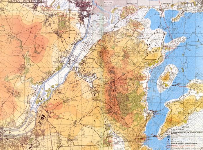
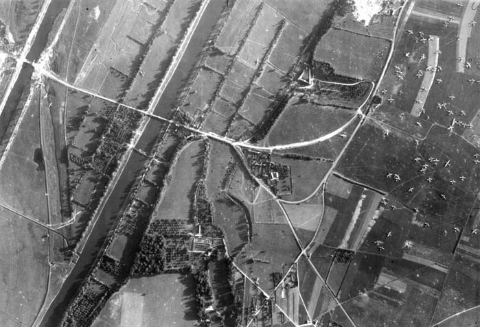
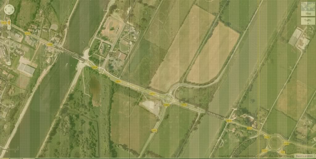
2. I do not have a map of the lay of the land, only a little dot where the town is, which gives nil topographical information to base the scenario map on, current day google earth will not show how it looked back then, and I can't find an older map, just this (http://www.pegasusarchive.org/normandy/Photos/Map_Tonga.htm)
3. What German unit did they go up against? The batallions held for weeks before being releaved(mad props!) and all it says is they took constant artillery and mortar fire and sporadic infantry assaults. What was the name of the German units they encountered?
4. The game does not feature British units yet so it'd have to wait for the Commonwealth pack, or shall I be a history heretic and put the Americans as the 5th brigade?
't Is a fascinating operation to be sure, and if I actually decide to make this I want to be able to do justice to it. My chief concern is just not knowing how the south side of that town looked, terrain wise. Wish there was a good, old map.")
Anyhow just some ramblings off the top of my head, maybe I'll decide that I wouldn't be able to do justice to it and call it a day, but it's worth brainstorming on.
Red devils!
Kimmy
In my 'hello' thread, Fredrocker suggested me to make a 1000x1000 scale map of Le Bas de Ranville, a small village south of the two bridges over the Caen Canal and the Orne, later known as the Horsa and Pegasus bridges. If i understand correctly, the plan was for the 6th Airborne Division to deploy it's 3rd and 5th parachutist brigade to Normandy, along with as many anti-tank guns as possible brought in by glider. Once landed, it was to make battle-ready as soon as possible and capture the two bridges in a swift manner, and to dig in against any counterattacks.
Little problem was that the bridges were rigged with explosives, so they chose to send each bridge half a dozen gliders, almost right on top of them, and take the garrison by surprise. It actually worked too, they set down a stones throw away, poured out of their gliders like a swarm of angry ticks and managed to conquer the bridges.
This operation was to be carried out by the 5th brigade of the 6th Airborne Division, and in more detail, it was the 12th Yorkshire and 13th Lancashire Batallions that were to capture Ranville and Bas de Ranville and hold it. (little wikipedia snippet now)These were line infantry converted to parachute duties,[13] and had to undergo airborne forces selection and training at the Airborne Forces Deport.[14][nb 2] On formation, each battalion had an establishment of 556 men in three rifle companies; the companies were divided into a small headquarters and three platoons. Each platoon had three Bren machine guns and three 2-inch mortars, one of each per section.[16] The only heavy weapons in the battalions were a 3 inch mortar platoon and a Vickers machine gun platoon.[17] By 1944 a headquarters or support company was added to the battalion, comprising five platoons: motor transport, signals, mortar, machine-gun and anti-tank. This company had eight 3 inch mortars, four Vickers machine guns, and ten PIAT anti-tank projectors.[16]
Despite my efforts I could not find out exactly which batallion held Ranville and which one had the slightly more southern line just south of Ranville(bas de ranville). I'm going to make a guess that it was the 12th Yorkshire batallion unless someone else can clarify it for me.
So I have a number of problems before I make this:
1. Which was it that held the south of Bas de Ranville(perhaps even both, so which one do I include in the scenario?)
2. I do not have a map of the lay of the land, only a little dot where the town is, which gives nil topographical information to base the scenario map on, current day google earth will not show how it looked back then, and I can't find an older map, just this (http://www.pegasusarchive.org/normandy/Photos/Map_Tonga.htm)
3. What German unit did they go up against? The batallions held for weeks before being releaved(mad props!) and all it says is they took constant artillery and mortar fire and sporadic infantry assaults. What was the name of the German units they encountered?
4. The game does not feature British units yet so it'd have to wait for the Commonwealth pack, or shall I be a history heretic and put the Americans as the 5th brigade?
't Is a fascinating operation to be sure, and if I actually decide to make this I want to be able to do justice to it. My chief concern is just not knowing how the south side of that town looked, terrain wise. Wish there was a good, old map.
Anyhow just some ramblings off the top of my head, maybe I'll decide that I wouldn't be able to do justice to it and call it a day, but it's worth brainstorming on.
Red devils!
Kimmy