- Joined
- Jun 5, 2021
- Messages
- 805
- Reaction score
- 1,139
- Age
- 55
- Location
- Wisconsin, USA
- Website
- www.youtube.com
@Aurelius -
I am moving our PM discussion to a thread so I can share proposed map files and pictures.
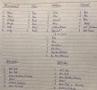
We agreed on a CMRT Probe QB, with you as the Soviet attackers. I used my randomizer (dice!) to create the following scenario parameters:
Forest, Day, Overcast, Lt.Snow on Ground
Soviet Armored Infantry vs. Gebirgsjaeger
From these parameters, I searched for a historical engagement in Winter 44-45 in which Gebirgsjaeger were employed in forested areas, resulting in the following "story" for our battle:
You will be leading a Medium Probe by the Soviet 73rd Guards Rifle Division (with armor support) against the 13th SS Handschar (Gebirgsjaeger) Division at Haromfa, Hungary around December 10, 1944, in an attempt to pierce the Margarettestellung. This gives us a good basis for making QB purchases that reflect the historical OOB.
References:
https://handscharhistory.wordpress.com/
https://www.worldhistory.biz/downlo...ionTheWaffen-SSHandscharDivision1943-1945.pdf Pages 277-280
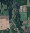
I pulled up Google Earth and topographical maps of the Haromfa area:
I then created a Master Map that we can cut down to a suitable battle area. The Master Map is 1776m x 2576m - far too large for a Medium battle.
I used the real-world elevations and tried to duplicate the real-world terrain features. I cut way back on the number of buildings, however. Haromfa is on a slight N-S ridge, with a fordable stream to the east, a lot of tree cover to the north and east, and farm fields to the extreme east and west flanks. There is a lake and a dam in the north that separates the potential Soviet starting zones. There is not a lot of significant elevation changes - mostly limited to a defile along the stream. There are slight rises and depressions in the fields.
As the Soviets would have been attacking from the north or east, the Master Map does allow for the Soviets to start from the wooded track and road in the North or from behind a slight slope on the east/northeast side of the map. It seems logical that objectives would have been the road junctions and the road south through Haromfa itself.
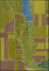
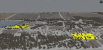
Looking northwest - I've proposed up to 4 different objectives on the Master Map:
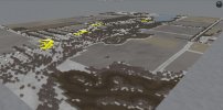
I attached a ZIP file containing the Haromfa Master Map, and my first attempt to cut down to a more manageable size (Haromfa Small) - 1248m x 1296m.
The Haromfa Small map would have 2 (maybe 3) objectives along the N-S road.
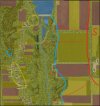
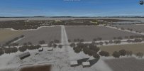
Looking east from the objectives:
Looking west from the proposed Soviet starting area:
I welcome your suggestions on how we cut this down for a Medium Probe, and then I can trim the map down, put in the starting zones, and adjust the objectives as needed.
I am moving our PM discussion to a thread so I can share proposed map files and pictures.
We agreed on a CMRT Probe QB, with you as the Soviet attackers. I used my randomizer (dice!) to create the following scenario parameters:
Forest, Day, Overcast, Lt.Snow on Ground
Soviet Armored Infantry vs. Gebirgsjaeger

From these parameters, I searched for a historical engagement in Winter 44-45 in which Gebirgsjaeger were employed in forested areas, resulting in the following "story" for our battle:
You will be leading a Medium Probe by the Soviet 73rd Guards Rifle Division (with armor support) against the 13th SS Handschar (Gebirgsjaeger) Division at Haromfa, Hungary around December 10, 1944, in an attempt to pierce the Margarettestellung. This gives us a good basis for making QB purchases that reflect the historical OOB.
References:
https://handscharhistory.wordpress.com/
https://www.worldhistory.biz/downlo...ionTheWaffen-SSHandscharDivision1943-1945.pdf Pages 277-280
I pulled up Google Earth and topographical maps of the Haromfa area:

I then created a Master Map that we can cut down to a suitable battle area. The Master Map is 1776m x 2576m - far too large for a Medium battle.
I used the real-world elevations and tried to duplicate the real-world terrain features. I cut way back on the number of buildings, however. Haromfa is on a slight N-S ridge, with a fordable stream to the east, a lot of tree cover to the north and east, and farm fields to the extreme east and west flanks. There is a lake and a dam in the north that separates the potential Soviet starting zones. There is not a lot of significant elevation changes - mostly limited to a defile along the stream. There are slight rises and depressions in the fields.
As the Soviets would have been attacking from the north or east, the Master Map does allow for the Soviets to start from the wooded track and road in the North or from behind a slight slope on the east/northeast side of the map. It seems logical that objectives would have been the road junctions and the road south through Haromfa itself.

Looking northwest - I've proposed up to 4 different objectives on the Master Map:

I attached a ZIP file containing the Haromfa Master Map, and my first attempt to cut down to a more manageable size (Haromfa Small) - 1248m x 1296m.
The Haromfa Small map would have 2 (maybe 3) objectives along the N-S road.

Looking east from the objectives:

Looking west from the proposed Soviet starting area:

I welcome your suggestions on how we cut this down for a Medium Probe, and then I can trim the map down, put in the starting zones, and adjust the objectives as needed.


