- Joined
- Oct 11, 2010
- Messages
- 12,704
- Reaction score
- 7,457
- Age
- 61
The first use of terrain models was for military purposes. The relief model allows a quick overview of a certain area. In a war, time is of essence. This means that the relief of the area of interest must be prepared before a possible conflict. However, nowadays the computer based production of terrain models allows production even in very short time, assumed the needed raw data including a digital terrain model already exist. A model of the landscape enables memorising the details much better than a map and minimises the risk of incorrect map reading. In addition the field of vision from each point is easily ascertained, something very important in war and not so easy to find out from a map. It is also possible to easily evaluate the coverage of a fire position.

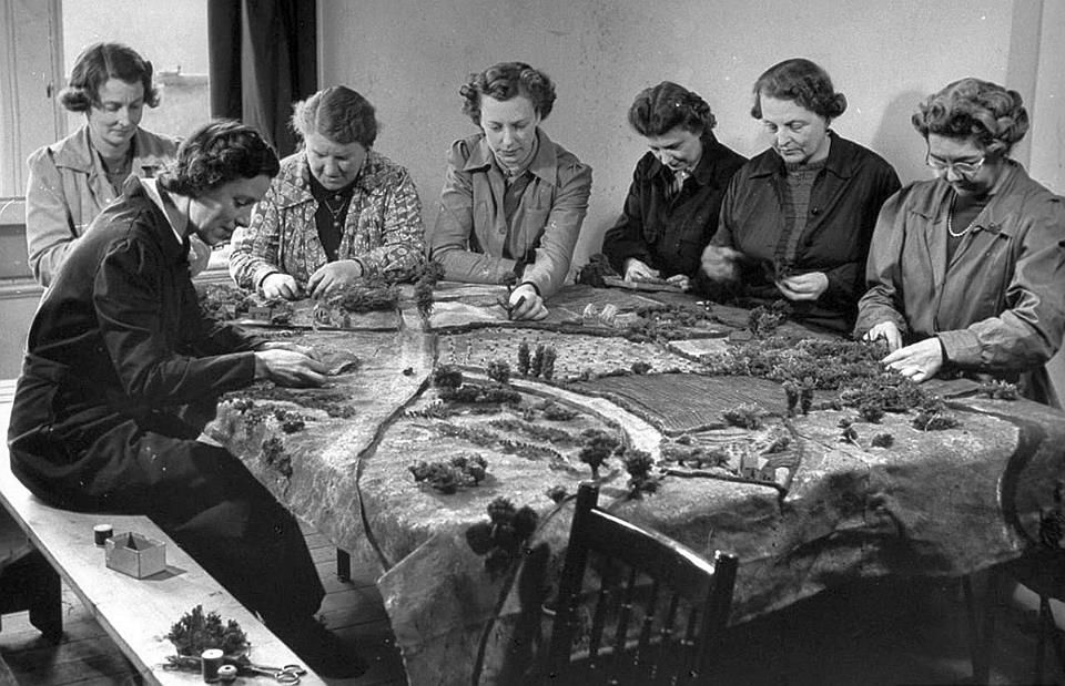
Women creating a 3D tactical map of Normandy during the WW2
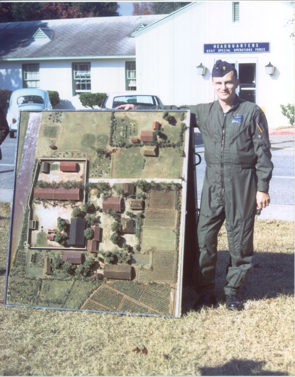
One of the best examples of a professionally done military terrain model is the prison camp model code named ‘Barbara’ in 1970, that was built to support the US Special Operations raid on the Son Tay Prison camp in North Vietnam.

The model (photo up) was built by professional modelers working for the CIA and was based on Corona satellite and SR-71 reconnaissance photos. Even the heights and crown diameters of the trees in and around the compound were properly scaled so the pilots could evaluate the best areas to set their helicopters down.
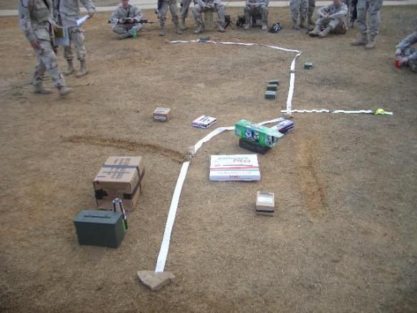
A terrain model can be something as simple as an impromptu sand table scratched out on the desert floor by a squad leader somewhere in Iraq (photo down), or a highly accurate, scaled and detail correct product built by modeling experts.

Today the digital world is awash in ‘terrain visualization’ software. Given the high resolution imagery and elevation datasets available for just about anywhere our military forces fight it is easy to generate realistic and accurate computer models almost on the fly. But still, nothing satisfies like a physical model (just like nothing satisfies like a paper map).
from:
terrainmodels.com
oldtopographer.net

Women creating a 3D tactical map of Normandy during the WW2
One of the best examples of a professionally done military terrain model is the prison camp model code named ‘Barbara’ in 1970, that was built to support the US Special Operations raid on the Son Tay Prison camp in North Vietnam.

The model (photo up) was built by professional modelers working for the CIA and was based on Corona satellite and SR-71 reconnaissance photos. Even the heights and crown diameters of the trees in and around the compound were properly scaled so the pilots could evaluate the best areas to set their helicopters down.
A terrain model can be something as simple as an impromptu sand table scratched out on the desert floor by a squad leader somewhere in Iraq (photo down), or a highly accurate, scaled and detail correct product built by modeling experts.

Today the digital world is awash in ‘terrain visualization’ software. Given the high resolution imagery and elevation datasets available for just about anywhere our military forces fight it is easy to generate realistic and accurate computer models almost on the fly. But still, nothing satisfies like a physical model (just like nothing satisfies like a paper map).
from:
terrainmodels.com
oldtopographer.net


