With CMBN 2.0 released and the new overlay feature in the editor working, I've started building a map for Joe's Bridge - "Bridge 0" of Operation Market Garden. The Irish Guards Guards took this area and formed a bridge head on the north side of the Maas - Scheldt Canal on the 10th of September in a a combined arms battle against dug in German Defenders. Joe's Bridge and the resulting bridgehead on the north side of the Canal formed the starting point of what would become Hell's Highway. What has always attracted me to this engagement was the combined arms action and the dogged German defence, the first many of the allies had seen following the end of Normandy and the liberation of Paris. It took air support and heavy artillery to finally clear the area. The poor Irish Guards who fought hard to take this bridge would find out soon after they were to continue being the head of the XXX Corps column for upcoming Operation Market Garden. Think Michael Caine's line "Christ, not us again," in the movie A Bridge to Far.
The map will incorporate the Zinc Refinery (British starting point) and the villages on either side of the German made pontoon bridge that were used to hold off counter attacks. Will obviously wait for the MG module for the scenario specifics but thought I could start setting out the map now. Would really like to know what new terrain we'll get.") Since we are closing in on the Ruhr, hoping some factory like buildings.
Since we are closing in on the Ruhr, hoping some factory like buildings.
I'm having trouble finding reference photos and ideally a map or aerial shot from 1944, so relying a little to much on Google for my liking. Any help and comments appreciated. Now I also hope this isn't a planned scenario for the module.
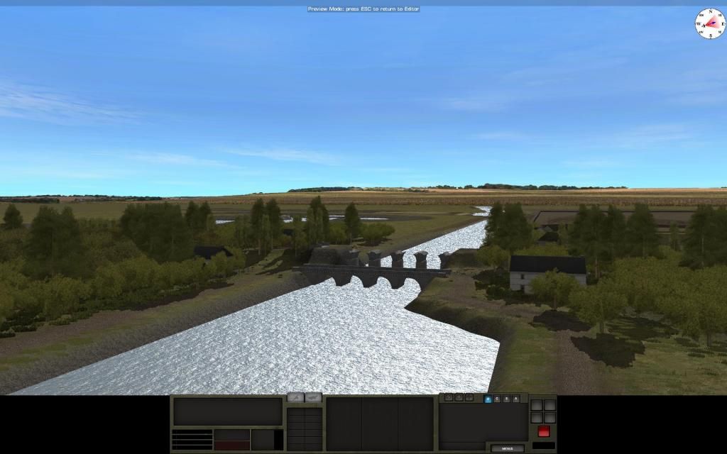
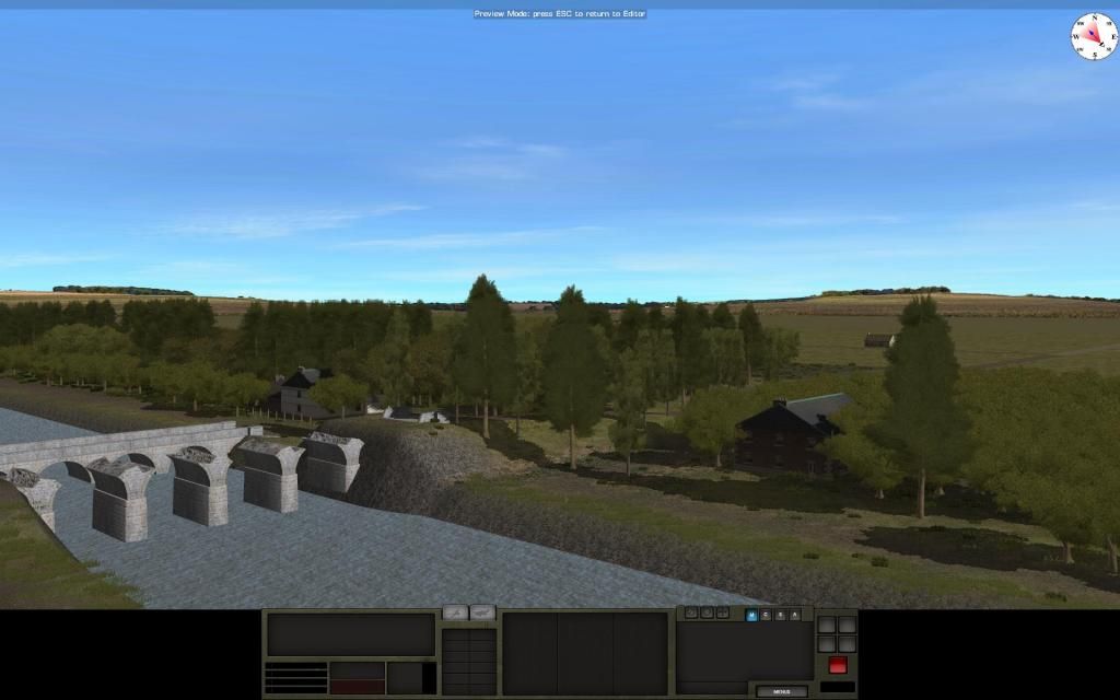
Bridge looking towards the east. Destroyed bridge is the main bridge that the Belgium army destroyed in 1940, the German's constructed a pontoon bridge next door.
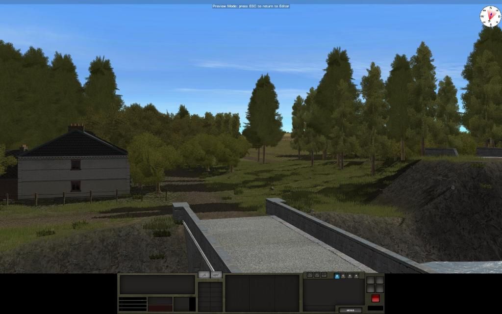
German side where an 88mm sat sighted down the road.
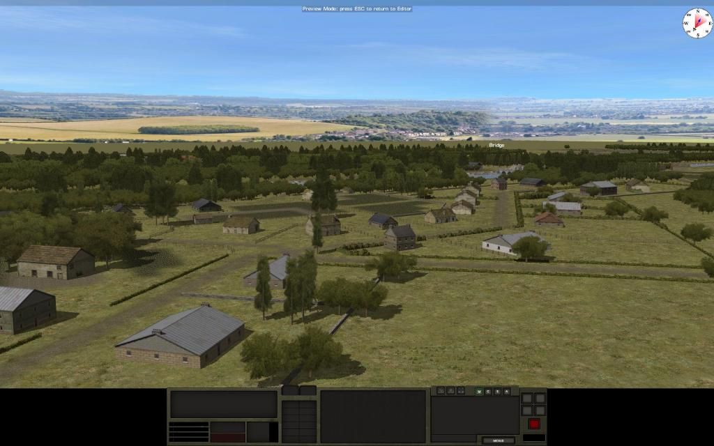
German side. Villiage of Kolonie will be behind this. The road leads to Valkensward, (not part of the map).
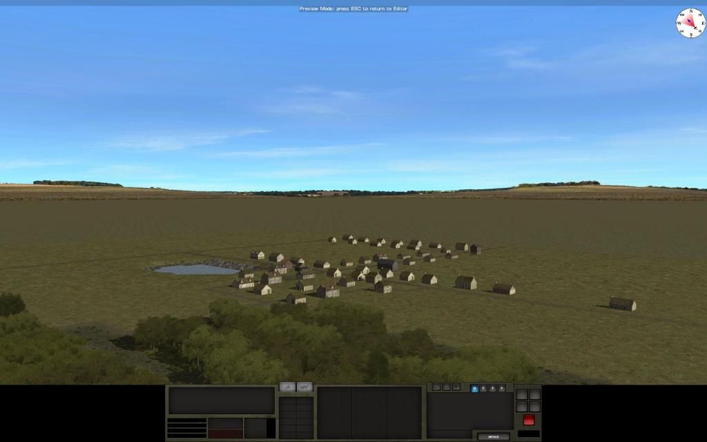
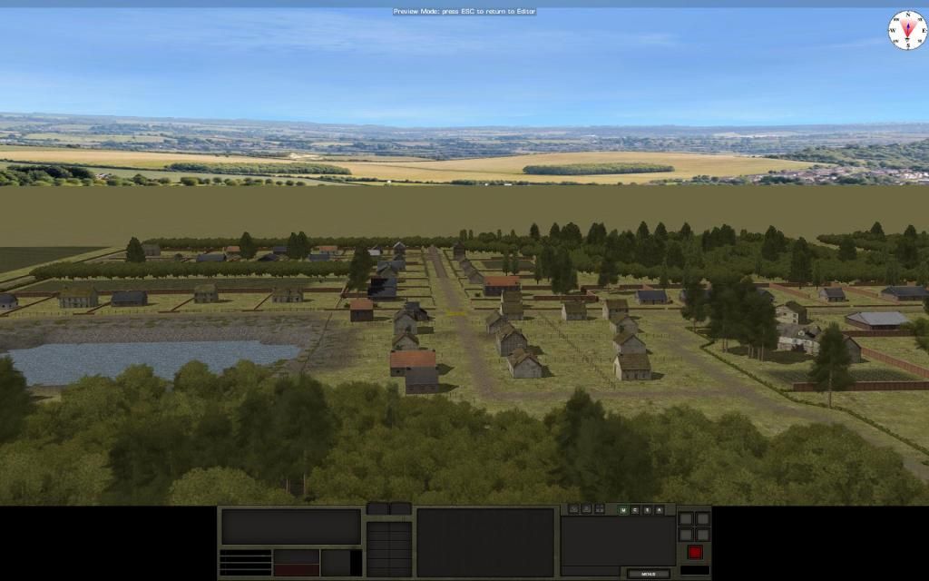
Kolonie village. Placeholders for now. Trying to get the crossing itself as accurate as possible, villages on either side will be best guess unless more source material is found.

British Southern Approach. Irish Guards came from the left of this picture along the canal itself as they were swinging through the towns of Neerpelt and Overpelt to surround SS forces fighting the Welsh Guards in Hechtel which you would hit if you followed this road further south.
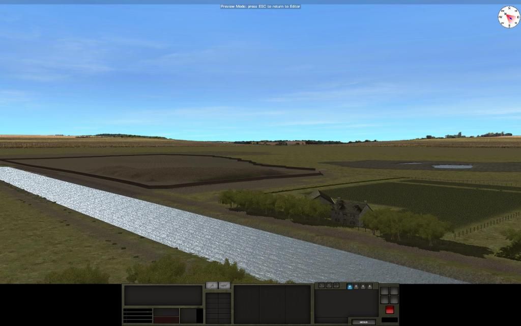
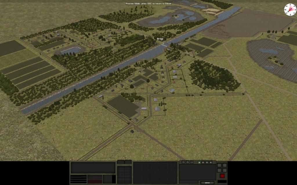
What will be the British deployment Zone. Zinc Refinery along the canal to the east of Joe's Bridge.
The map will incorporate the Zinc Refinery (British starting point) and the villages on either side of the German made pontoon bridge that were used to hold off counter attacks. Will obviously wait for the MG module for the scenario specifics but thought I could start setting out the map now. Would really like to know what new terrain we'll get.
Since we are closing in on the Ruhr, hoping some factory like buildings.I'm having trouble finding reference photos and ideally a map or aerial shot from 1944, so relying a little to much on Google for my liking. Any help and comments appreciated. Now I also hope this isn't a planned scenario for the module.
Bridge looking towards the east. Destroyed bridge is the main bridge that the Belgium army destroyed in 1940, the German's constructed a pontoon bridge next door.
German side where an 88mm sat sighted down the road.
German side. Villiage of Kolonie will be behind this. The road leads to Valkensward, (not part of the map).
Kolonie village. Placeholders for now. Trying to get the crossing itself as accurate as possible, villages on either side will be best guess unless more source material is found.
British Southern Approach. Irish Guards came from the left of this picture along the canal itself as they were swinging through the towns of Neerpelt and Overpelt to surround SS forces fighting the Welsh Guards in Hechtel which you would hit if you followed this road further south.
What will be the British deployment Zone. Zinc Refinery along the canal to the east of Joe's Bridge.