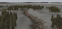
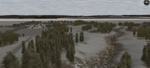
Western Front campaign anyone?

Early days obviously. First thing for my designs is to define central zone features and build around those.
While the city map I'm building for the Urban Warrior campaign will be defined mostly by buildings and streets,
this very rural map will be defined primarily by elevation changes, both subtle and marked.
 
I like that each little part of the map has a defining feature.

About the ravine, are you making sure the stream at the botton doesn't sometimes flow upwards? That's always a bit of an immersion killer for me.
 
It's kind of a long bowl really. Each end of the ravine comes up to ground level, and I used a little finishing thingy in the editor which looks like it's meant to be a source for the water.

Doing this rural map has been so easy compared to the urban map and I'm enjoying the change of pace.
Each zone is only taking a couple of hours or so. I'm still working on the urban one, but a nice change of pace.
Hopefully it will be a fun map to fight on for the campaign.

If I keep chipping away at this one, it may even be ready before the urban one.
 
I think the new terrain in the frying pan and the spine looks a bit too "kaleidoscopic".. the blobs of trees seem almost symmetrical.
 
I'll work on it some more.

Just a note about trees and ridges...
I had a look at a bunch of aerial photos of ridges.
Some were devoid of vegetation. Some had trees only on one side.

But in general, there seemed to be no rhyme or reason.
The area covered by trees and low vegetation seemed sporadic and in clumps.
Made it hard to go for a realistic look, other than slapping it down in a similar way.
 
Last edited:
I'm often wondering how much countryside was left to nature back in the 1940's. Would you have big areas of forest and open grassland right next to a village? If so, why would nobody have claimed this land and farmed it? This is not a critique of your map, just something I'm thinking about.
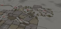
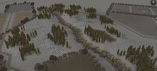
Depending on the area, the terrain and soil may not be suitable for farming, plus if it's later in the war, I imagine many places had a shortage of farmhands due to conscription and farmland was left fallow. No expert on farming by a longshot, just my 2 cents :)
 
The Draw

(I know, I know, another ditch in the earth. I'll now move on to other types of land features) :)
In my defense, The bridge, The Spine (a small ridge), The Ravine and The Gully all join up and provide continuity.
The Draw is further down the line however.

By the way, if anyone has ideas for a terrain feature, let me know.
Here is my current ideas list:

The Spur
The Farm
The Woods
The Sunken Lane / The Needle
The Plateau
The Station
The Vineyard
The Camp / The Base / The Outpost

draw 01.jpg

draw 02.jpg

draw 03.jpg

draw 04.jpg
 
Back
Top Bottom